Geocaching Swiss Army Knife – Next Generation
Your geocaching.Reimagined. Made simpler.
A modern look. Familiar controls. Support when you need it.
GSAK-NG takes geocache management into the next generation. Keep your overview, prepare your next trip and choose the interface that works for you.
GSAK-NG complements Cachly and c:geo – it is not intended to replace or compete with these established geocaching apps. Keep using your favourite app for your adventures; GSAK-NG adds tools for data management, searching and preparation. The mobile app follows the same complementary approach.
In development and testing · Windows · macOS · Linux · Android · iPhone & iPad
 You seek adventure.I think alongside you. 😉Meet Burgi ↗
YOUR NEXT CHAPTERGSAK-NG
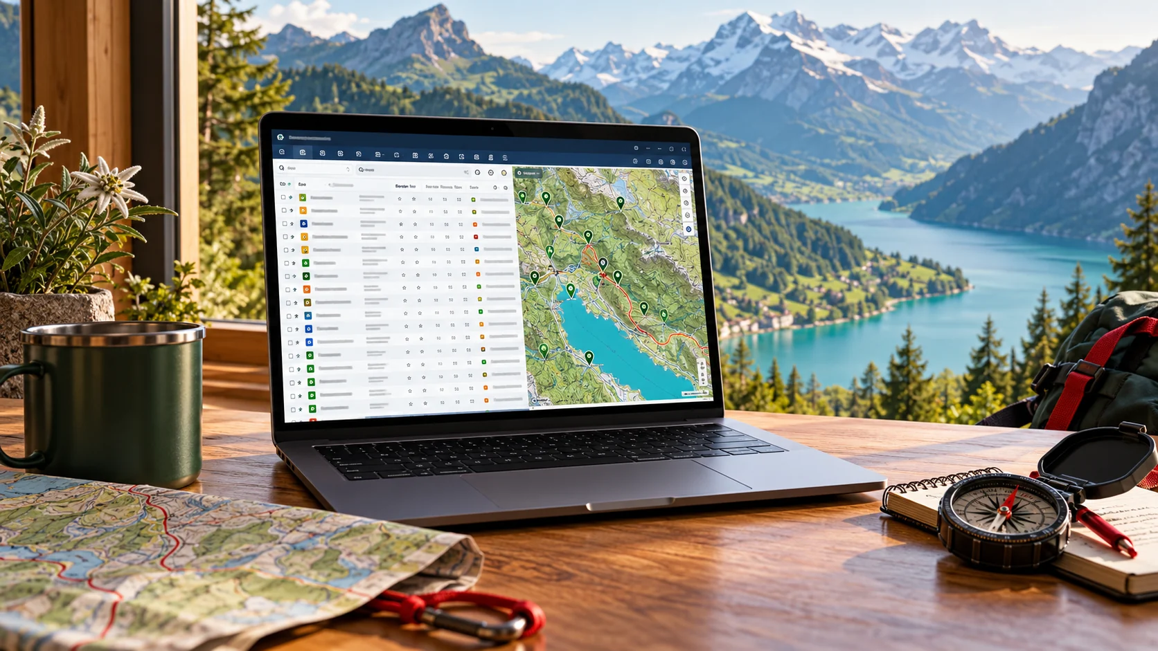
Your view. Your choice.
Classic ↔ Modern
Product vision · AI illustration
OUR COMMITMENT FOR RELEASE
100% GSAK-compatible at launch.
Your databases. Your filters. Your macros.
Established capabilities remain – a new generation joins them.
Filter compatibility
Macro compatibility
Current test versions are still progressing towards this scope. The 100% commitment applies to release, not to today’s test build.
UNTIL THE PLANNED PRODUCT LAUNCH
Coming soon.
Planned product launch: 15 December 2026
HERE FOR YOU IN 11 LANGUAGES
Currently in internal testing
More maps. More tools. More your style.
Swiss and worldwide hybrid maps, hiking and cycling maps and additional offline formats expand your view. Macro management, an editor with error checking, custom macro buttons and a visual form designer simplify recurring tasks. Organised settings, light/dark mode, F2 split screen and backup and restore round out the internal test build. This development build is being tested internally and is not a public release.
Data, GPX & sharing 15
Plan once. Cache together.
The QR scanner is easier to find on mobile. Preview what you are importing and create a new destination database directly from the desktop preview. QR transfer is in development.
120,000 caches. Feels like 10.
In Reto’s hands-on test, using the app on a PC and phone with 120,000 caches felt as fast as with 10. Large GPX files import in the background.
Keep it with the cache
Attach photos and files to caches or waypoints. Mobile details group descriptions, logs, notes, attributes and waypoints into their own sections. Integrated and automatically checked; some real camera, gallery and cloud tests remain open. Cross-device cloud synchronisation is not yet verified.
Take your trackables along
Export personal trackables with images and import them with a preview and conflict selection. This does not provide an automatic online inventory.
Maintain your data
Check, compact and copy desktop databases, replace values globally and clean up logs. Changes use a preview or confirmation and a backup. These maintenance workflows do not modify original GSAK databases.
Clearer GPX reports
The GPX analyser visibly confirms saving and offers HTML or JSON reports. Items that cannot be checked include an explanation. Desktop improvements have been checked on Windows; macOS and Linux checks will follow. Your original file remains unchanged.
More complete GSAK data transfer
Additional log, waypoint and corrected-coordinate details, image references and ignore lists have reached the main development branch. Synthetic test data demonstrates further transfers; image files themselves are not copied. Full compatibility remains our major goal, with verification continuing.
Bring more of your GSAK data.
Transfer expands to additional log, waypoint and correction details, image references and the ignore list. Image references are not copied image files. Synthetic-data checks expand; repeat reference checks are pending. Full losslessness is not promised.
Compatibility with traceable evidence.
A new field comparison checks GSAK databases using a reference copy and protects originals with checksums. Reading and transfer are demonstrated for specific data areas; fully lossless transfer and direct two-way editing are not yet demonstrated. Full compatibility remains our goal.
Your move from GSAK. Guided and clear.
In test Build 29: an assistant to inventory, preview and transfer databases, supported filters and macro files. Originals stay protected; limitations appear in the report.
Import. Review. Share.
Import reports distinguish new, updated, unchanged and skipped caches with a searchable change list. Select Pocket Query email attachments for controlled import; the mailbox is read only. Prepare GPX files for handover, drag them or copy their path. macOS also has a system sharing menu implementation. GSAK-NG sends nothing itself. Real mailbox and sharing-menu checks are still pending.
Cache details with more clarity.
An image gallery, clear attribute icons with marked exclusions, a log overview and a more informative status bar enrich the details. Formatted text and clearer links, trackables and hint sections help navigation. Images load only according to the chosen setting; real listings and Mac/Linux display remain under practical testing.
Share data. See changes first.
When an export profile changes notes, GPX export shows a preview before writing and provides a change report. Original notes and the database remain unchanged. Real target-import tests with Cachly are still pending.
From your favourite app straight to GSAK-NG.
Receive files using Share or Open with. Choose a destination and review the preview before importing. Integrated and automatically tested; device tests are pending.
Plan once. Continue together with a QR code.
Connect desktop, phone and caching friends: choose what to share and review the import preview. The transfer chain is integrated; the live transfer service and end-to-end device tests are pending. In development.

Search, filters & logs 8
Search history
Recent name and GC-code searches will be accessible from the search field. In development.
GC code, cache link or place – one search entry
A shared search entry for desktop and mobile recognises GC codes, cache links, places and coordinates. It searches your database; missing caches are not downloaded automatically. Implemented and automatically tested; real mobile keyboard use and device acceptance remain unverified.
Choose cache types precisely
All official cache types can be selected, including CITO, Mega, Giga and Lab. Integrated and locally checked. Group-trip and fellow-cacher filters with AND/OR and FTF candidates are additionally in development; full mobile desktop parity has not been reached.
Your filters. More possibilities on the go.
Saved filters and criteria for status, attributes, favourite points, year and name, owner, country or region extend mobile search. Pausing preserves criteria. Automated development tests pass; device tests remain pending.
Series sorted naturally. Status seen faster.
Natural sorting orders names such as Cache #2, #19, #20. GC codes can show status through a coloured cell background or text colour. Implemented in desktop development and locally checked on Windows; platform checks are separate.
Tap briefly. Hold longer. Filter easily.
In mobile test Build 30, a short tap opens filter settings; a long press pauses or reactivates the filter. Criteria are preserved, including across restarts.
Understand logs. Prepare your own.
Search logs and filter by type or your own entries. Create personal log templates with variables and review each draft individually. Preparation stays local; online publishing remains a separate goal.
One right-click. Your matching filter.
Filter directly by values in the table. Integrated into the main branch.
Maps, navigation & trips 14
Offline across borders
Download mobile routing data by country or region for cross-border routes. Progress, resuming and checksum validation are prepared. Real country packages and device routes still need testing. iOS offline routing needs further integration. Routing data and visible offline maps are separate development steps.
Continue with your navigation app
Pass a cache or waypoint to an installed navigation app, preferring corrected coordinates. Mobile integration and automated checks are complete; practical tests with individual apps and iOS remain open. GSAK-NG continues to complement Cachly and c:geo.
Your route to the target
Mobile walking, cycling and driving routes are implemented online through openrouteservice. Offline routing with Valhalla and imported regional data is integrated too. Real mobile online requests and a real offline route with regional data are not yet demonstrated; iOS routing is still under review.
More control on the go
Correct coordinates offline on mobile and confirm a reset to the preserved original. Four compass designs and a storage overview with controlled cache cleanup are integrated. Some real-device checks for these additions remain open.
Keep track of events
Calendar handover is implemented on desktop: review and edit event details, then pass them to a calendar app or save an ICS file. Mobile filters continue to grow: status, text fields, placement year, favourites, attributes and saved filters are integrated. Full desktop parity including the interactive D/T matrix remains open. Calendar handover is now implemented on mobile too; the Android preview step was checked, while real calendar and iOS tests remain open.
Mobile maps are evolving
A new vector map is being trialled: cache groups, selection, waypoints, rotation and a direct line to your target. An Android test version exists; iOS integration and further device checks are ongoing. A persistent north-up lock is also being trialled.
From the cache to the next stage.
Choose a parking spot, stage or final waypoint as a straight-line target. A large compass view adds a target arrow, distance, altitude, accuracy and coordinates. Metric or imperial; optional vibration near the target. Automated checks exist; practical tests pending.
Your map. Your terrain. On the go.
Mobile map selection with swisstopo, topographic maps, aerial imagery, hybrids, overlays and custom HTTPS sources is implemented. Android phone checked in an emulator; tablet and iOS evidence pending. Key-protected sources and local offline map files remain follow-up work.
Keep your destination in sight.
Mobile straight-line guidance with location, distance and bearing, a north-up compass button, location following and heading alignment are implemented in development. Automated and Android emulator checks exist; real GPS and compass device tests remain pending. No background tracking; straight-line guidance is not routing.
Find places. Even offline.
Over 172,000 places for radius searches without an online place service. Add country, region and district from coordinates with a preview. Included in desktop Build 25.
List and map. Together on the go.
Mobile Build 30 links a side-by-side list and map with shared selection and an adjustable split. Available to internal testers through TestFlight; split view, filter pause, light/dark display and seasonal icons checked on real iPhone and iPad. iOS GPX import/export remain untested. Android emulator checks pass. Mobile currently offers German and English; nine more languages are planned. No public release.
Mobile: your data and map on the go.
The Android test build offers GPX/ZIP import, GSAK/GSAK-NG database transfer through a protected copy, database selection, a map, search, cache details and personal notes. Layout adapts to phone and tablet. Mobile Build 30 links a side-by-side list and map with shared selection and an adjustable split. Available to internal testers through TestFlight; split view, filter pause, light/dark display and seasonal icons checked on real iPhone and iPad. iOS GPX import/export remain untested. Android emulator checks pass. Mobile currently offers German and English; nine more languages are planned. No public release.
See original and corrected positions.
Show original points and correction lines on desktop and mobile. Integrated and automatically tested.
Explore the surroundings before your trip.
Open Street View at the selected location. Depending on platform and configuration, it opens inside the app, in Google Maps or in the browser. Integrated into the main branch.
Mysteries & tools 9
Solve multis with a clearer view
The multi assistant detects unknown variables, helps take values from text and shows calculated waypoints on a live map. Multiline hints provide room for your tasks.
Find tools faster. Read details more easily.
A searchable mobile tool overview gives each tool more space. Further coordinate copy formats, clearer map-source listings, optional ROT13 spoiler protection for hints and desktop D/T default colours are also in development.
More tools for tricky mysteries
Caesar and ROT13, Roman numerals and further number tools expand the desktop and mobile toolbox. Automated tests are documented; practical platform checks remain outstanding.
Examine images, discover hidden clues
Sudoku solving, image metadata, appended file contents and text analysis are prepared. Files are read locally, never modified or uploaded. Colour channels and bit planes are planned for desktop only. Automated tests passed; device checks remain outstanding.
More mystery tools
Letter values with a custom starting value A=n and prime-number mappings extend the desktop and mobile toolbox. Local tests are available; operation on real mobile devices still needs checking.
Solve multis. Keep your ideas.
The desktop multi assistant combines variables, formulas and calculated waypoints. Projects are included in backups. The toolbox is now implemented on mobile too, with clear results that can be copied individually.
Your geocaching toolbox
Implemented on desktop: coordinate conversion including Swiss Grid, bearings, multiple bearings, circle intersections, Morse and letter values. Copy results or confirm before adding a waypoint. The desktop multi assistant combines variables, formulas and calculated waypoints. Projects are included in backups. The toolbox is now implemented on mobile too, with clear results that can be copied individually.
Small helpers. Precise results.
Coordinate helpers add digit sums, digital roots and geographic midpoints. Elevations can be exported as CSV for spreadsheets.
Use formulas. Prepare multis more easily.
Review formulas detected in cache descriptions before applying them. Integrated and automatically tested; real-device tests are pending.
Interface & platforms 11
Your interface. Your storage.
Selectable cache-symbol shapes, optional status markers and custom macro-button symbols or monograms personalise the desktop. Data folders can be copied, moved or redirected in a controlled workflow. Integrated and locally checked; practical relocation and platform tests remain open.
Your data. Your colours.
Custom conditional colour rules with a preview highlight important caches. Choose their priority over status colours. Mobile display will follow.
Easier to use
Search commands, open tools directly and share cache links. The classic layout offers the table above details and map. Switch descriptions between standard, HTML and source; mobile HTML is simplified and shows image placeholders.
Try it. See it. Decide.
Settings preview applies the appearance immediately; Cancel restores the previous state. Seasonal found icons gain three Easter styles from Palm Sunday to Easter Monday. Implemented and locally checked on desktop; mobile Easter settings follow.
Your system. Your settings.
On Windows, optionally choose GSAK-NG as the default app through system settings and switch back; practical association testing pending. Android system bars and automatic light/dark switching improved and emulator-checked; real-device testing pending.
Your tools. Your way.
In test Build 29: custom shortcuts and profiles with conflict checks, plus selectable coordinate and date formats and first day of the week.
Controls that fit you.
In desktop test Build 29: choose the double-click action, sort by distance after changing the centre and customise row colours. Identify your own caches with wildcards and regular expressions.
A touch of the season. On the go.
Optionally show found caches as pumpkins at Halloween and with a Santa hat in December. You can turn this off. Map attribution is also easier to read in dark mode.
11 app languages. Now selectable.
German and English plus nine further languages can be selected in the app. French, Spanish, Italian, Portuguese, Dutch, Danish, Swedish, Czech and Polish are initially unreviewed translation previews. Native-speaking testers are welcome.
Your table. Clearer at a glance.
Cache types as icons or text, container-size scales and optional numeric colour scales improve the overview. Organised settings, personal places and targeted map zoom add convenience.
Find mobile settings faster.
Grouped settings, search and a visible save confirmation. Integrated into the main branch.
Burgi, macros & help 6
More comfort for macros
Multiple file tabs, automatic indentation and contextual help make editing easier. Saving without changes preserves the file format. Full GSAK macro compatibility remains a goal requiring verification.
German beta handbook
An initial German handbook preview explains workflows for desktop and mobile. HTML and PDF are being prepared. A public download will follow approval.
What is new? Inside the app.
An overview of new and improved features and updated About pages are implemented and locally checked for desktop and mobile; mobile was also checked in an Android emulator. Public release is still pending.
Burgi. On the go, too.
The mobile Burgi page brings the familiar character, expressions and first local helper functions to phones and tablets. Support grows step by step – discover more with us during testing.
Familiar macros. New paths.
Build 29 improves GSAK macro path handling on macOS and Linux. Automated Windows, macOS and Linux checks pass. Full compatibility with all GSAK macros remains our major goal; it has not yet been demonstrated.
Your macros. Directly in GSAK-NG. With you everywhere.
Planned: install macros directly from the public library. Your account will remember your macro selection so you can find it again after changing devices or operating systems.
New in testing
More inside. For your next find.
New options for your workspace – and a next step for Mac and Linux geocachers.
Windows · macOS · Linux
First test version
Test versions for Windows x64, macOS and Linux are available for testing. Features and requirements depend on the respective test package. Include your operating system when joining the beta test.
Join the beta test ↗Table and map. Together when you want.
Show or hide the map in classic view independently of the F2 details panel. Adjust its width; map and cache selection stay linked.
Set up. Take along. Keep going.
Export and import configuration, select areas and preview changes. Keys are transferred only by explicit choice and with password protection. Device-specific paths are not copied blindly.
A touch of glass. Just your style.
Optional glass menus with adjustable opacity and preview. Main window and content stay opaque; menus also stay opaque where the system provides no blur effect.
See more. Understand faster.
Additional columns, trackable icon and count, clear attribute symbols, highlighted favourite points and well-structured logs. Missing data remains visibly unknown.
GSAK-NG
Your geocaching. On more platforms.
Windows x64
✓ In the test version
macOS
✓ In the test version
Linux
✓ In the test version
Test versions for Windows x64, macOS and Linux are available for testing. Features and requirements depend on the respective test package. Include your operating system when joining the beta test.
Planned · Apple CarPlay · Android Auto
GSAK-NG in the car, too.
Apple CarPlay and Android Auto are planned as a separate future extension of the mobile app. Possible uses include viewing a prepared trip and handing a selected destination to an existing navigation app.
Apple CarPlay
○ Planned
Android Auto
○ Planned
Technical feasibility and required platform approvals still need to be established. Features, supported vehicles and availability will be announced later.
MORE POSSIBILITIES. FEWER DETOURS.
Made for your preparation.
From the first import to your next trip: your data, your workflow and support along the way.
Green: working features in the test version. Light grey: features in development or planned for later.
Your data. Your overview.
Manage multiple databases, import GPX and Pocket Queries and export for GSAK, c:geo or Cachly. Existing GSAK databases are read without changes.
✓ In the test versionPowerful search. Simple discovery.
Quick filters, a D/T matrix and full-text search help you find your caches. For advanced searches, combine filters with your own read-only SQL WHERE conditions.
✓ In the test versionPlan ahead on the map.
See caches and the selected cache’s child waypoints. Corrected and original coordinates remain clearly distinguishable.
✓ In the test versionKeep your thoughts with your cache.
Edit notes and coordinate corrections in your GSAK-NG database. Your edits survive a new GPX import.
✓ In the test versionMenus that work your way.
Reorder commands, hide entries and create your own menus. Familiar keyboard shortcuts keep actions close at hand.
✓ In the test versionStart familiar. Go modern.
Switch between a classic table and a modern view with a list, map and details. Keep your database, filters and selection.
✓ In the test versionBack up. Restore. Keep exploring.
Back up databases and settings and restore them in a controlled way. Automatic backup on exit is optional, with a confirmation if desired. On failure, retry or cancel closing. Back up databases and settings and restore them in a controlled way. Automatic backup on exit is optional, with a confirmation if desired. On failure, retry or cancel closing.
✓ In the test versionYour tools, within reach.
Custom toolbars, flexible columns and undoing filter changes will extend your personal workspace. Show or hide the map in classic view independently of the F2 details panel. Adjust its width; map and cache selection stay linked. Optional glass menus with adjustable opacity and preview. Main window and content stay opaque; menus also stay opaque where the system provides no blur effect. Custom highlighting rules and further hover effects remain development goals.
✓ In the test versionMake repeat tasks easier.
Macro support is growing. Selected workflows are being tried; compatibility with existing GSAK macros is still being checked. Full GSAK macro compatibility remains a development goal.
◷ In developmentA wide choice of maps. Your way.
OpenStreetMap, OpenTopoMap, swisstopo maps and aerial imagery, hybrid maps and hiking and cycling maps offer many perspectives. Custom XYZ/TMS sources, overlays and supported local raster MBTiles, GeoPackage and PMTiles files extend the choice. Availability, coverage and terms depend on platform and source.
✓ In the test versionYour idea. Easier to achieve. With Burgi.
Familiar tools. New possibilities. And someone thinking alongside you. Burgi brings intelligent support to your geocaching day – helping even demanding tasks feel easier. The first possibilities are already being tested. What is behind it? Discover more at launch.
◷ In developmentMultilingual. Closer to you.
The website is available in German, English, French, Spanish, Italian, Portuguese, Dutch, Danish, Swedish, Czech and Polish. The app is also planned in the same 11 languages. Released translations depend on the app version. German and English plus nine further languages can be selected in the app. French, Spanish, Italian, Portuguese, Dutch, Danish, Swedish, Czech and Polish are initially unreviewed translation previews. Native-speaking testers are welcome.
◷ In developmentMore possibilities ahead.
Sharing, translation, Geocaching API integration and syncing between devices are future goals. Scope, prerequisites and dates remain open.
○ Planned featuresDevelopment status – the scope of the test version may vary
Burgi
Your idea. Easier to achieve. With Burgi.
Burgi is already learning.
Familiar tools. New possibilities. And someone thinking alongside you. Burgi brings intelligent support to your geocaching day – helping even demanding tasks feel easier.
I have an idea … 😉
The first possibilities are already being tested. What is behind it? Discover more at launch.
Join the beta testMeet Burgi here on the website. The mascot is a preview – no AI chat is connected here yet.
In development · Burgi
Your idea. Your macro. No programming skills needed.
Tell Burgi in your own words what you want to accomplish. We are developing guided assistance that prepares a personal macro, explains the steps clearly and helps you make adjustments.
Less repetition. More time for geocaching.
Recurring tasks should become easier to prepare and save as your own tools.
You stay in control.
A draft is not executed automatically. You decide what is saved and when a macro may run.
Development is underway. Availability and supported tasks depend on the released version.
Interface
Start familiar. Explore something new.
Discover new possibilities without giving up the way you work.
Classic view
A focused table and familiar workflows, for anyone who wants their data in plain sight.
Modern interface
A new perspective on your caches: list, map and details brought together.
Schematic illustration of the interface concepts, not a screenshot of the current software.
Long-term outlook
Thinking further. Step by step.
Additional future options whose concepts, prerequisites and implementation still need to be defined.
Your settings. Across your devices.
Optional syncing of your personal configuration is a long-term consideration.
More ways to use GSAK-NG.
Server or cloud operation with user management is an additional future option: explore shared data and controlled access. Architecture, hosting and operation remain open.
Questions about GSAK-NG
Getting started & switching
What is GSAK-NG?
GSAK-NG stands for Geocaching Swiss Army Knife – Next Generation. This independently developed geocaching software combines database management, GPX tools, search and a classic or modern interface. The project is in development.
Which languages does the website support?
The website is available in German, English, French, Spanish, Italian, Portuguese, Dutch, Danish, Swedish, Czech and Polish. The app is also planned in the same 11 languages. Released translations depend on the app version.
How can I test GSAK-NG?
Contact gsak-ng@burger.swiss to express interest in beta testing. GSAK-NG is being developed and tested for Windows, macOS, Linux, Android, iPhone and iPad. Features and availability depend on the test version; a public download is not offered here yet.
Can I use GSAK-NG alongside GSAK?
Yes. GSAK-NG uses its own data folders and reads existing GSAK databases without writing to them. Your GSAK installation is not changed.
Can I bring my existing data?
You can import GPX and open GSAK databases read-only. Caches can be copied into your own GSAK-NG database. Complete handling of all GSAK-specific data is still being checked; start with test data or copies.
Do I need to learn a new interface?
Choose a classic table or a modern view with a list, map and details. Familiar workflows, keyboard shortcuts and customisable menus help you get started.
Does GSAK-NG already replace every GSAK feature?
Full feature parity is a long-term goal. The actual functions included depend on each version and its release notes.
Will my existing macros work?
Macro support is growing and selected workflows are being tried. Full compatibility with all GSAK macros has not yet been demonstrated. Test your macros with non-critical data first.
Maps, search & assistance
How can I find matching geocaches?
Quick filters, a D/T matrix and full-text search help narrow your selection. For advanced searches, the integrated test build supports your own read-only SQL WHERE conditions on GSAK and GSAK-NG databases. These SQL conditions do not apply directly to standalone GPX files.
What can Burgi do for me?
Familiar tools. New possibilities. And someone thinking alongside you. Burgi brings intelligent support to your geocaching day – helping even demanding tasks feel easier. The first possibilities are already being tested. What is behind it? Discover more at launch.
Do I need an internet connection?
Local data management and GPX work do not need a continuous connection. Online maps and cloud AI need internet; local AI depends on your chosen provider. An expanded offline-map package using local raster MBTiles is in development.
Will my data be sent to an AI service?
It depends on the feature and provider. The current filter helper sends your request, available filter fields and a short filter description, not your entire cache database. Your selected provider determines whether processing is local or in the cloud.
Which maps can I use?
OpenStreetMap, OpenTopoMap, swisstopo maps and aerial imagery, hybrid maps and hiking and cycling maps offer many perspectives. Custom XYZ/TMS sources, overlays and supported local raster MBTiles, GeoPackage and PMTiles files extend the choice. Availability, coverage and terms depend on platform and source.
Platforms & contact
Can I test GSAK-NG on macOS and Linux too?
Windows x64 and first test versions for macOS and Linux can be tested. Scope and requirements depend on the test package. Tell us your operating system when joining the beta test.
Is GSAK-NG free?
Yes. GSAK-NG is free and has no advertising.
How do I report bugs or suggest features?
Write to gsak-ng@burger.swiss. For bugs, include the app version, operating system, reproduction steps and expected versus actual behaviour. Do not include credentials or private cache data.
Contribute
Your idea could be the next highlight.
What is missing from your geocaching? Tell us what GSAK-NG should do for you.
We could use your experience. 😉
BE THERE BEFORE EVERYONE ELSE.
Your experience matters. Help shape GSAK-NG.
You know what works well in your current tools – and what costs you time. That is exactly the experience we need. Try GSAK-NG before the planned product launch and help shape the next generation with your feedback.
Count me in for the beta
Beta registration opens soon. Check back shortly.
In development and testing · Windows · macOS · Linux · Android · iPhone & iPadHERE FOR YOU IN 11 LANGUAGES
See all news
- What’s new?
- Explore together. Carry more possibilities.
- Discover more. Move forward more easily.
- Your cache. Your files. Your way there.
- More possibilities. At your desk and on the go.
- More tools. More clarity. More possibilities.
- Get started faster. Discover what is new.
- Burgi comes along. So does your next destination.
- More orientation. More your GSAK-NG.
- More freedom. From your desk to your next cache.
- From import to the trail: your geocaching comes together.
- More possibilities. Now together in testing.